Go beyond your boundaries and explore the world as never before.
The capital of Dutch St. Maarten stretches about a mile (1½ km) along an isthmus between Great Bay and the Salt Pond and has five parallel streets. Most of the village's dozens of shops and restaurants are on Front Street, narrow and cobblestone, closest to Great Bay. It's generally congested when cruise ships are in port, because of its many duty-free shops and several casinos. Little lanes called steegjes connect Front Street with Back Street, which has fewer shops and considerably less congestion. Along the beach is a ½-mile-long (1-km-long) boardwalk with restaurants and several Wi-Fi hot spots.
Wathey Square (pronounced watty) is in the heart of the village. Directly across from the square are the town hall and the courthouse, in a striking white building with cupola. The structure was built in 1793 and has served as the commander's home, a fire station, a jail, and a post office. The streets surrounding the square are lined with hotels, duty-free shops, restaurants, and cafés. The Captain Hodge Pier, just off the square, is a good spot to view Great Bay and the beach that stretches alongside.
Antigua's capital, with some 45,000 inhabitants (approximately half the island's population), lies at sea level at the inland end of a sheltered northwestern bay. Although it has seen better days, a couple of notable historic sights and some good waterfront shopping areas make it worth a visit. At the far south end of town, where Market Street forks into Valley and All Saints roads, haggling goes on every Friday and Saturday, when locals jam the Public Market to buy and sell fruits, vegetables, fish, and spices. Ask before you aim a camera; your subject may expect a tip. This is old-time Caribbean shopping, a jambalaya of sights, sounds, and smells.
If you fly to the 32-square-mile (83-square-km) island of St. Thomas, you land at its western end; if you arrive by cruise ship, you come into one of the world's most beautiful harbors. Either way, one of your first sights is the town of Charlotte Amalie. From the harbor you see an idyllic-looking village that spreads into the lower hills. If you were expecting a quiet hamlet with its inhabitants hanging out under palm trees, you've missed that era by about 300 years. Although other islands in the USVI developed plantation economies, St. Thomas cultivated its harbor, and it became a thriving seaport soon after it was settled by the Danish in the 1600s. The success of the naturally perfect harbor was enhanced by the fact that the Danes—who ruled St. Thomas with only a couple of short interruptions from 1666 to 1917—avoided involvement in some 100 years' worth of European wars. Denmark was the only European country with colonies in the Caribbean to stay neutral during the War of the Spanish Succession in the early 1700s. Thus, products of the Dutch, English, and French islands—sugar, cotton, and indigo—were traded through Charlotte Amalie, along with the regular shipments of slaves. When the Spanish wars ended, trade fell off, but by the end of the 1700s Europe was at war again, Denmark again remained neutral, and St. Thomas continued to prosper. Even into the 1800s, while the economies of St. Croix and St. John foundered with the market for sugarcane, St. Thomas's economy remained vigorous. This prosperity led to the development of shipyards, a well-organized banking system, and a large merchant class. In 1845 Charlotte Amalie had 101 large importing houses owned by the English, French, Germans, Haitians, Spaniards, Americans, Sephardim, and Danes. Charlotte Amalie is still one of the world's most active cruise-ship ports. On almost any day at least one and sometimes as many as eight cruise ships are tied to the docks or anchored outside the harbor. Gently rocking in the shadows of these giant floating hotels are just about every other kind of vessel imaginable: sleek sailing catamarans that will take you on a sunset cruise complete with rum punch and a Jimmy Buffett soundtrack, private megayachts for billionaires, and barnacle-bottom sloops—with laundry draped over the lifelines—that are home to world-cruising gypsies. Huge container ships pull up in Sub Base, west of the harbor, bringing in everything from breakfast cereals to tires. Anchored right along the waterfront are down-island barges that ply the waters between the Greater Antilles and the Leeward Islands, transporting goods such as refrigerators, VCRs, and disposable diapers. The waterfront road through Charlotte Amalie was once part of the harbor. Before it was filled in to build the highway, the beach came right up to the back door of the warehouses that now line the thoroughfare. Two hundred years ago those warehouses were filled with indigo, tobacco, and cotton. Today the stone buildings house silk, crystal, and diamonds. Exotic fragrances are still traded, but by island beauty queens in air-conditioned perfume palaces instead of through open market stalls. The pirates of old used St. Thomas as a base from which to raid merchant ships of every nation, though they were particularly fond of the gold- and silver-laden treasure ships heading to Spain. Pirates are still around, but today's versions use St. Thomas as a drop-off for their contraband: illegal immigrants and drugs. To explore outside Charlotte Amalie, rent a car or hire a taxi. Your rental car should come with a good map; if not, pick up the pocket-size "St. Thomas–St. John Road Map" at a tourist information center. Roads are marked with route numbers, but they're confusing and seem to switch numbers suddenly. Roads are also identified by signs bearing the St. Thomas–St. John Hotel and Tourism Association's mascot, Tommy the Starfish. More than 100 of these color-coded signs line the island's main routes. Orange signs trace the route from the airport to Red Hook, green signs identify the road from town to Magens Bay, Tommy's face on a yellow background points from Mafolie to Crown Bay through the north side, red signs lead from Smith Bay to Four Corners via Skyline Drive, and blue signs mark the route from the cruise-ship dock at Havensight to Red Hook. These color-coded routes are not marked on most visitor maps, however. Allow yourself a day to explore, especially if you want to stop to take pictures or to enjoy a light bite or refreshing swim. Most gas stations are on the island's more populated eastern end, so fill up before heading to the north side. And remember to drive on the left!
With a lush interior featuring towering mountains, dense rain forest, fertile valleys, and acres of banana plantations, St. Lucia is mostly distinguished by the Pitons—twin peaks that soar high above the ocean floor on the southwest coast. Whether you stay in Soufrière, in the north in or around Rodney Bay Village, or even farther north at Cap Estate, exploring the iconic natural sights—and local history—in Soufrière is a day well spent. Except for a small area in the extreme northeast, one main highway circles all of St. Lucia. The road snakes along the coast, cuts across mountains, makes hairpin turns and sheer drops, and reaches dizzying heights. It takes at least four hours to drive the whole loop. Even at a leisurely pace with frequent sightseeing stops, and whether you’re driving or being driven, the curvy roads make it a tiring drive in a single outing. The West Coast Road between Castries and Soufrière (a 1½-hour journey) has steep hills and sharp turns, but it's well marked and incredibly scenic. South of Castries, the road tunnels through Morne Fortune, skirts the island's largest banana plantation (more than 127 varieties of bananas, called "figs" in this part of the Caribbean, grow on the island), and passes through tiny fishing villages. Just north of Soufrière the road negotiates the island's fruit basket, where most of the mangoes, breadfruit, tomatoes, limes, and oranges are grown. In the mountainous region that forms a backdrop for Soufrière, you will notice 3,118-foot Mt. Gimie (pronounced Jimmy), St. Lucia's highest peak. Approaching Soufrière, you'll have spectacular views of the Pitons; the spume of smoke wafting out of the thickly forested mountainside just east of Soufrière emanates from the so-called "drive-in" volcano. The landscape changes dramatically between the Pitons and Vieux Fort on the island's southeastern tip. Along the South Coast Road traveling southeasterly from Soufrière, the terrain starts as steep mountainside with dense vegetation, progresses to undulating hills, and finally becomes rather flat and comparatively arid. Anyone arriving at Hewanorra International Airport, which is in Vieux Fort, and staying at a resort near Soufrière will travel along this route, a journey of about 45 minutes each way. From Vieux Fort north to Castries, a 1½-hour drive, the East Coast Road twists through Micoud, Dennery, and other coastal villages. It then winds up, down, and around mountains, crosses Barre de l'Isle Ridge, and slices through the rain forest. Much of the scenery is breathtaking. The Atlantic Ocean pounds against rocky cliffs, and acres and acres of bananas and coconut palms blanket the hillsides. If you arrive at Hewanorra and stay at a resort near Castries or Rodney Bay, you'll travel along the East Coast Road.
The capital of Dutch St. Maarten stretches about a mile (1½ km) along an isthmus between Great Bay and the Salt Pond and has five parallel streets. Most of the village's dozens of shops and restaurants are on Front Street, narrow and cobblestone, closest to Great Bay. It's generally congested when cruise ships are in port, because of its many duty-free shops and several casinos. Little lanes called steegjes connect Front Street with Back Street, which has fewer shops and considerably less congestion. Along the beach is a ½-mile-long (1-km-long) boardwalk with restaurants and several Wi-Fi hot spots.
Wathey Square (pronounced watty) is in the heart of the village. Directly across from the square are the town hall and the courthouse, in a striking white building with cupola. The structure was built in 1793 and has served as the commander's home, a fire station, a jail, and a post office. The streets surrounding the square are lined with hotels, duty-free shops, restaurants, and cafés. The Captain Hodge Pier, just off the square, is a good spot to view Great Bay and the beach that stretches alongside.
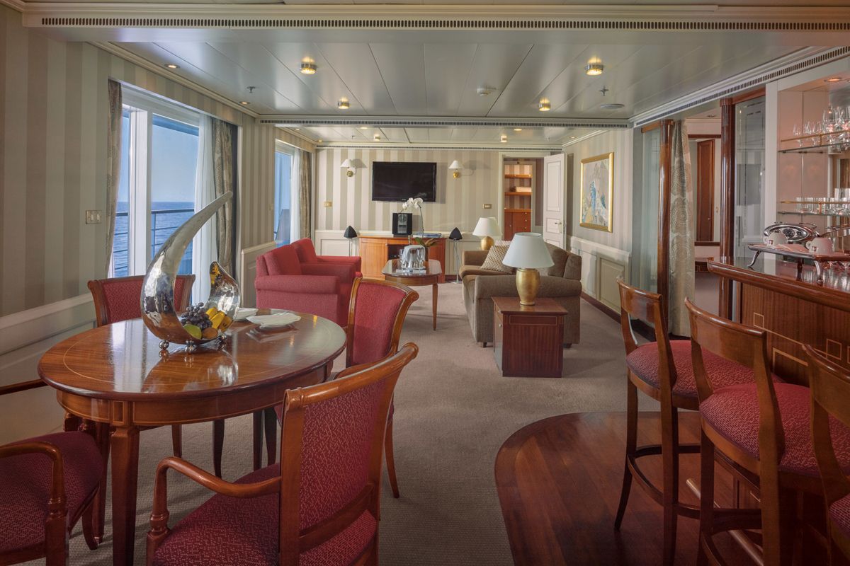
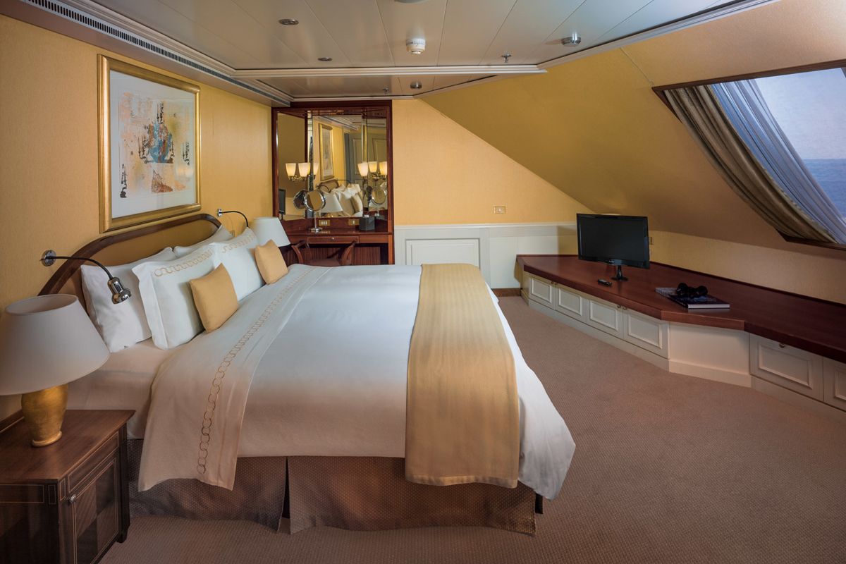
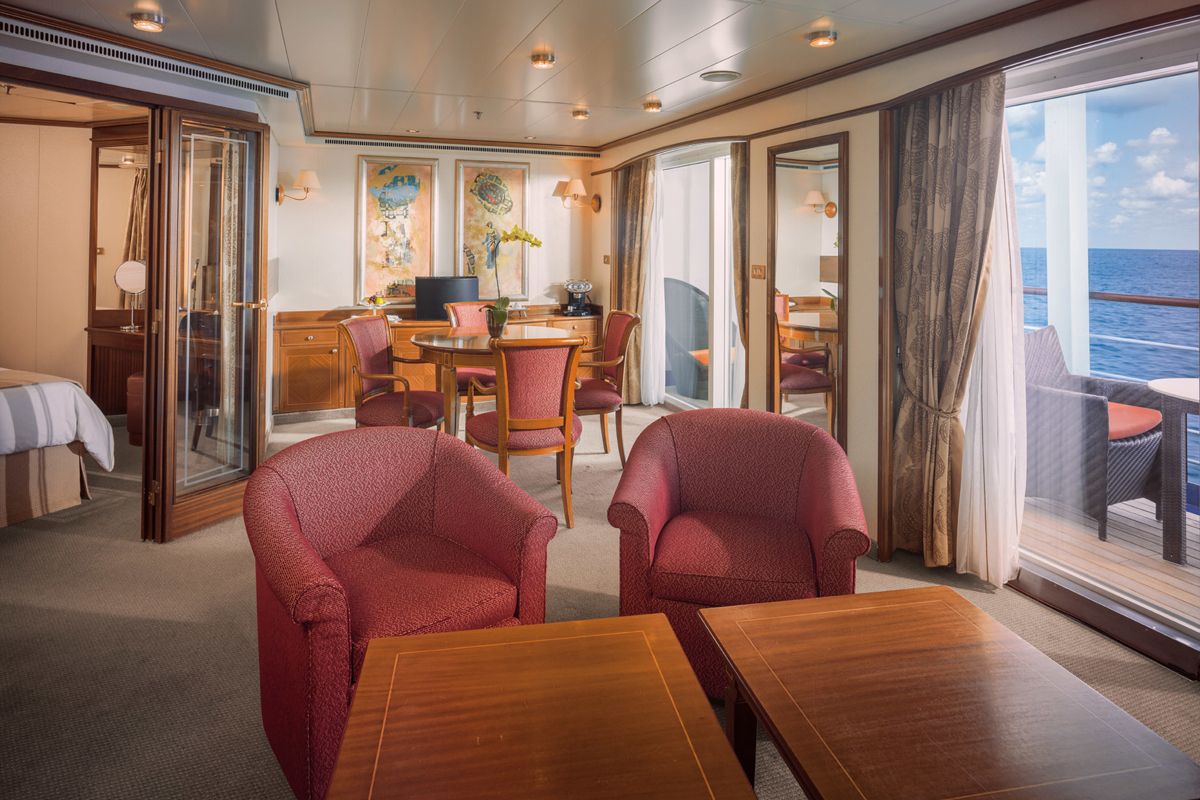
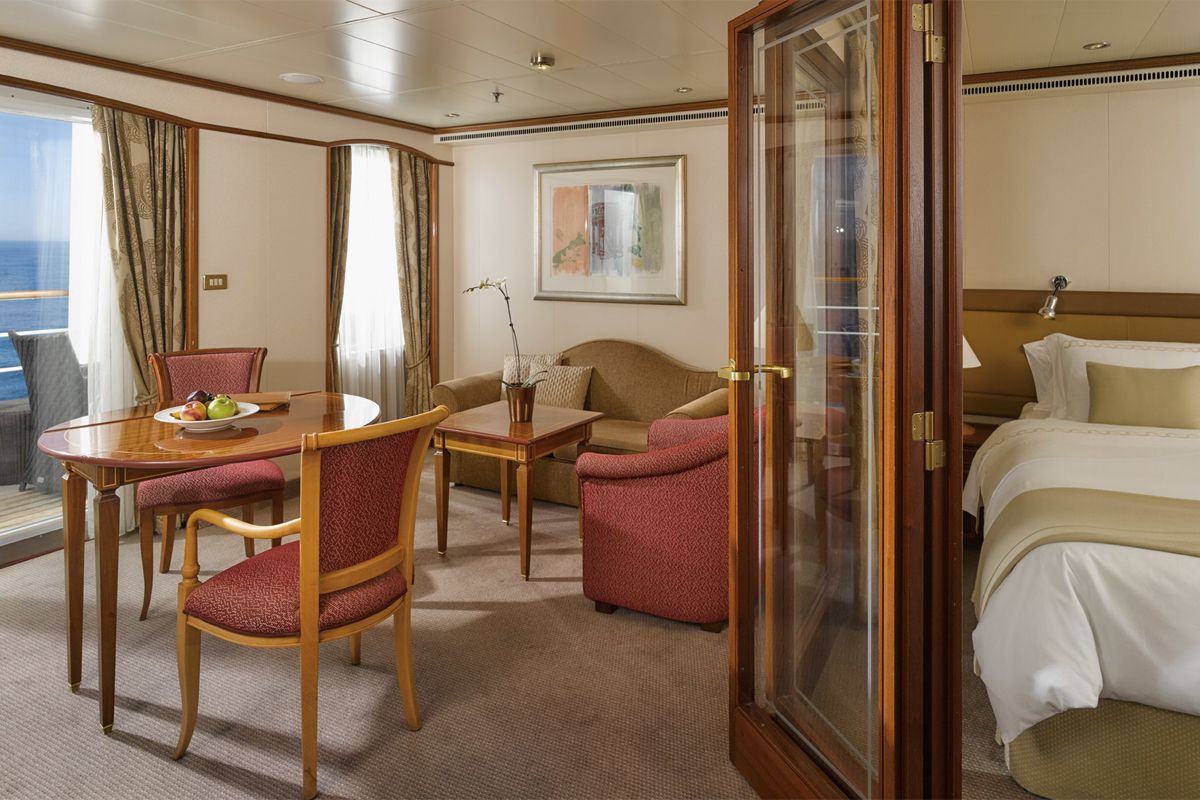
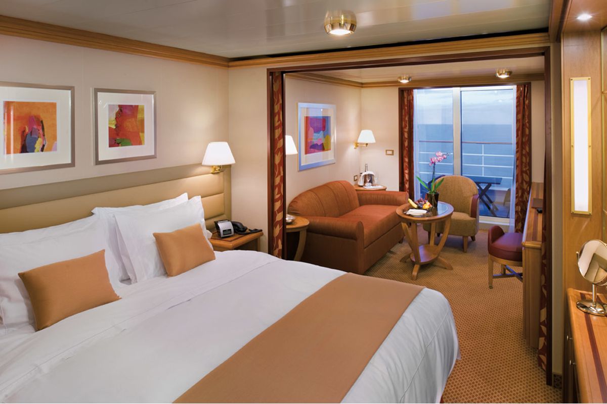
World Cruise Finder's suites are some of the most spacious in luxury cruising.
Request a Quote - guests who book early are rewarded with the best fares and ability to select their desired suite.